
The controversial Aquind Interconnector proposed route of the cables includes tunneling under important community facilities and protected habitats plus deep and disruptive trenches gouging through vital road links, though dense urban areas and areas for recreation and nature. There is also the temporary but deeply disruptive long-term use of carparks and other public spaces during the years of installation.
Below is a video where you can follow the proposed route of the Aquind interconnector project from the ground and from the air. See where the cables are due to arrive from France into Eastney, cutting all the way through Portsmouth and then onwards through Hampshire including Widley, Purbrook, Waterlooville, Denmead, and finally Lovedean.
The below video is a deep dive in to the issues surrounding the proposed Aquind Interconnector project and the legacy of contaminated land in Portsmouth. The proposed route for deep trench digging will be past or through some locations that are well documented to contain heavy metals, asbestos and more contaminants. A full list of sources and references are located at the end of the film. At time of publishing, all effort was made to use the most up to date and accurate public information in the writing and creation of this video, and to reference all copyrighted material used/shown as fair dealing for criticism, review or quotation and for the purpose of reporting current events.
Follow the proposed route below with our visual diagrams showing the disruptive route plans, from the point where the cables arrive from France via The Solent all the way through to when they leave Portsmouth heading north into Hampshire. These proposed route images are based on the current latest route document in the planning application and the areas shown are approximate and may not be exact (it is difficult to map 2D plans to 3D images precisely). These images are free to share and distribute, and we actively encourage you to share them via Social Media. Drone photography and images provided by Strong Island Media.
If you want to get in touch about how you can help and get involved, please visit our Contact page.
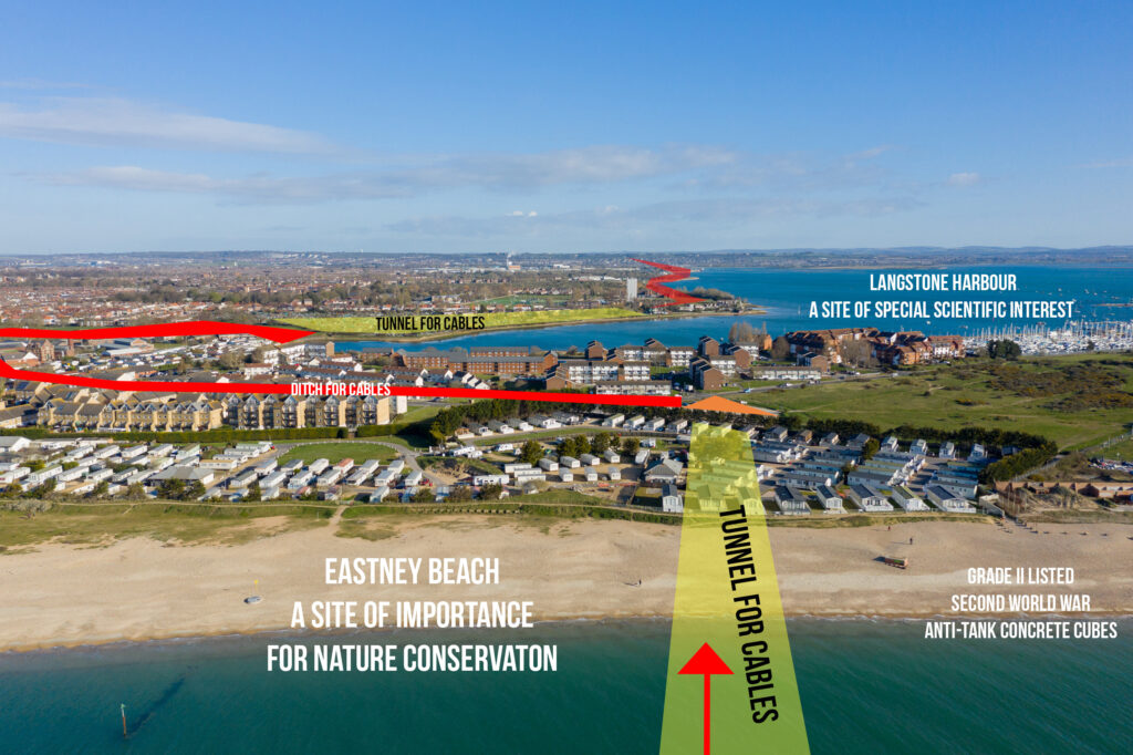
Cables arrive from France via The Solent and cut into Eastney.
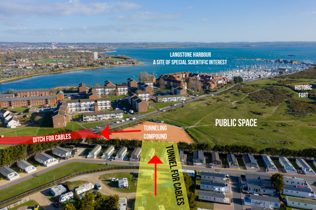
The busy carpark used often by walkers and dog walkers will be taken over for a tunneling compound and junction building.
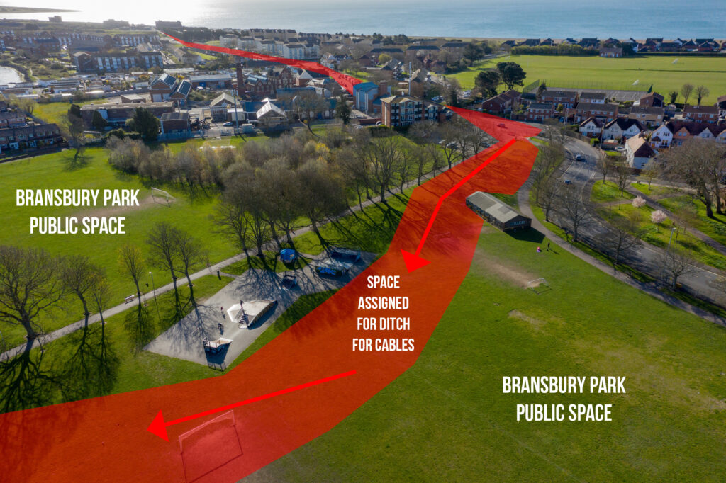
The route cuts through Eastney on the main road before carving through the public spaces of Bransbury Park in Milton.
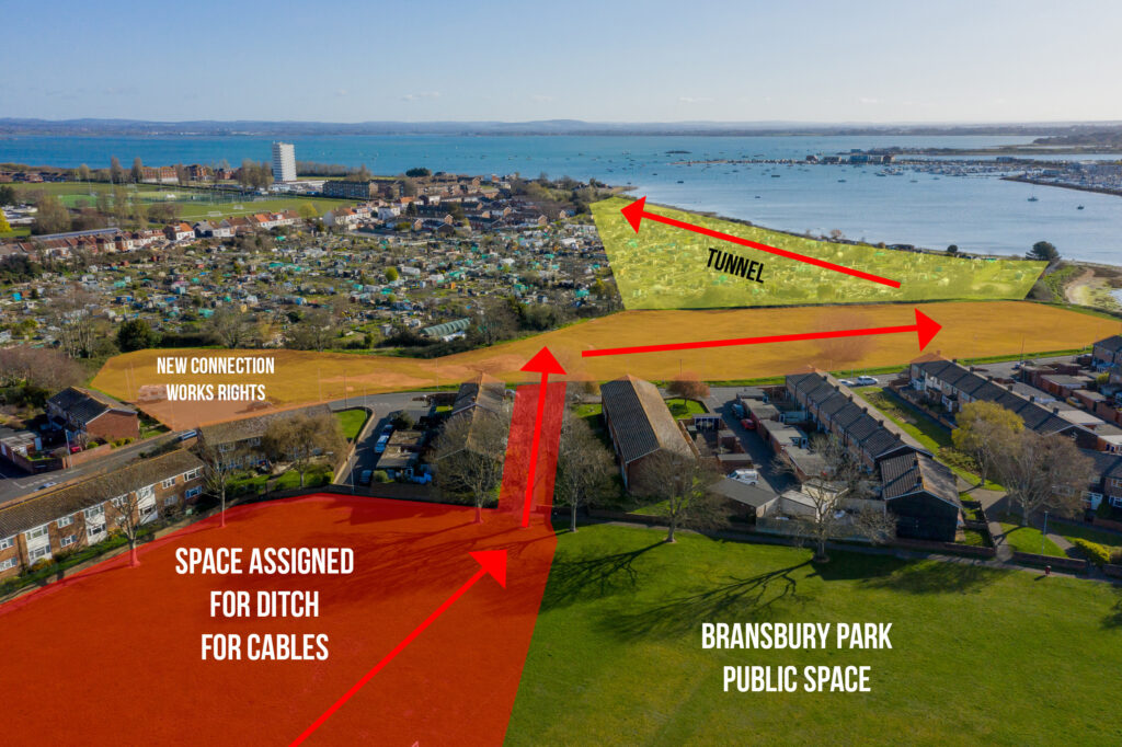
Much of the northeast corner of the park is shown to be needed before the cables cut past people’s houses before taking over another green community space.
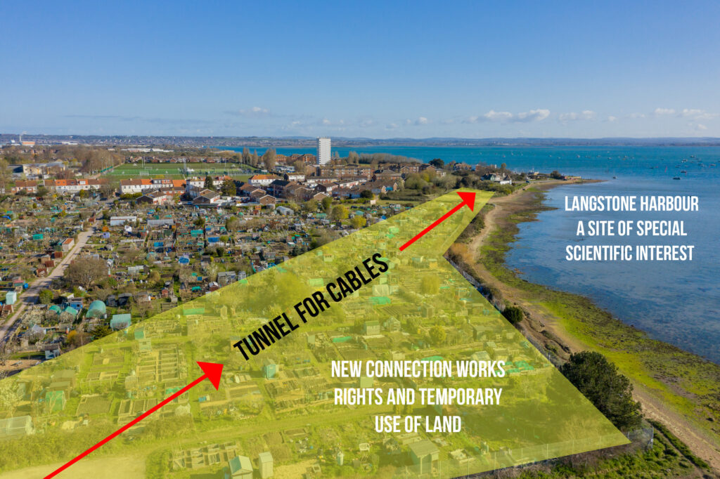
The cables are due to tunnel under Milton Allotments but access will be needed at numerous points.
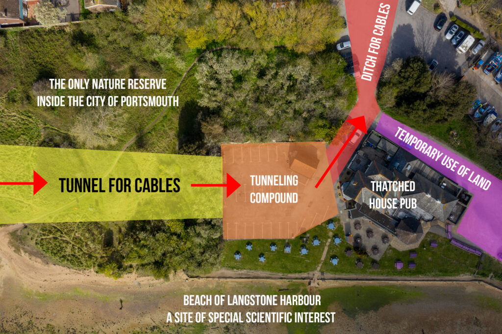
The cables go under Hampshire and Isle of Wight Wildlife Trust’s Milton Locks Nature Reserve, the only nature reserve in the city of Portsmouth, and used regularly to teach local children about their natural habitats in a heavily urban city. The car park at The Thatched House public house will be taken over as a compound, the hugely popular boardwalk carpark at Milton Locks is also shown to be used temporarily.
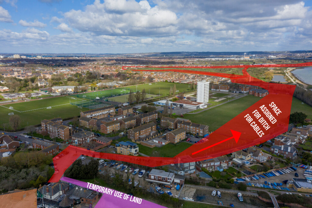
The cables will leave Milton Locks along Locksway Road (blocking houses and the sailing club) before cutting through the University of Portsmouth’s Furze Lane Campus. The route then cuts swathes of land through Milton Common before either cutting through housing or directly through Milton Common to the Eastern Road.
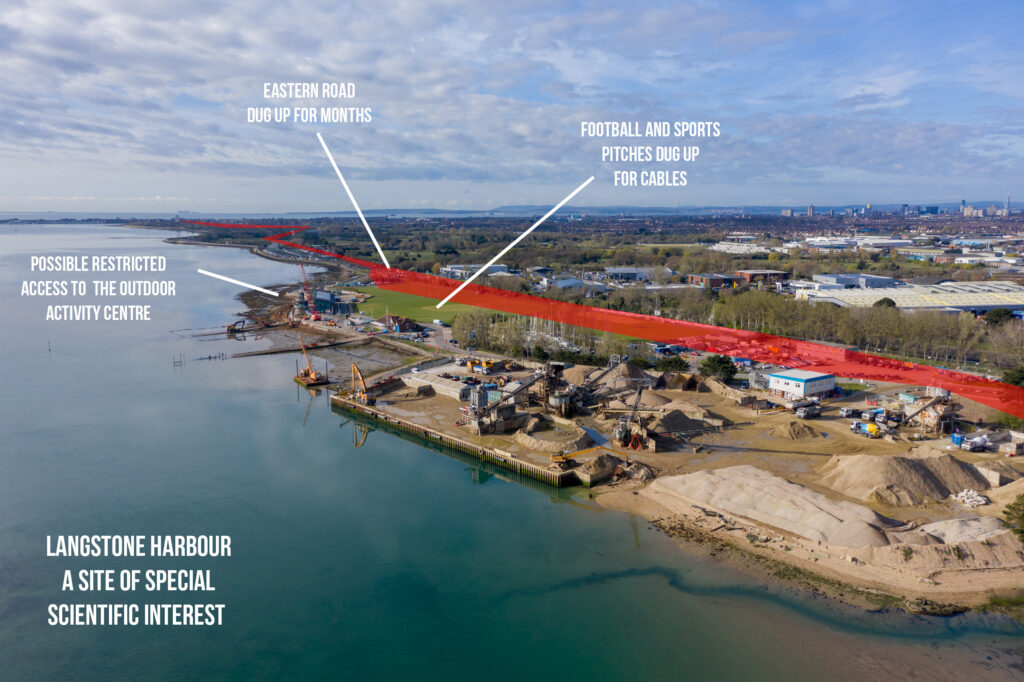
The Eastern Road is a vital link into/out of Portsmouth (only three roads go on/off Portsea Island), the road is often very busy with traffic. The cables cut through much of Eastern Road before carving through sports and a football pitch (used by Portsmouth FC Women’s team) and cause access issues to the outdoor activity centre. This may also dig up land recently landscaped for the coastal defenses work, with a tunneling compound where the cables head north under Langstone Harbour.

The cables will travel north under Langstone Harbour, a site of special scientific interest, plus home to vitally important saltmarsh and seagrass meadow habitats.
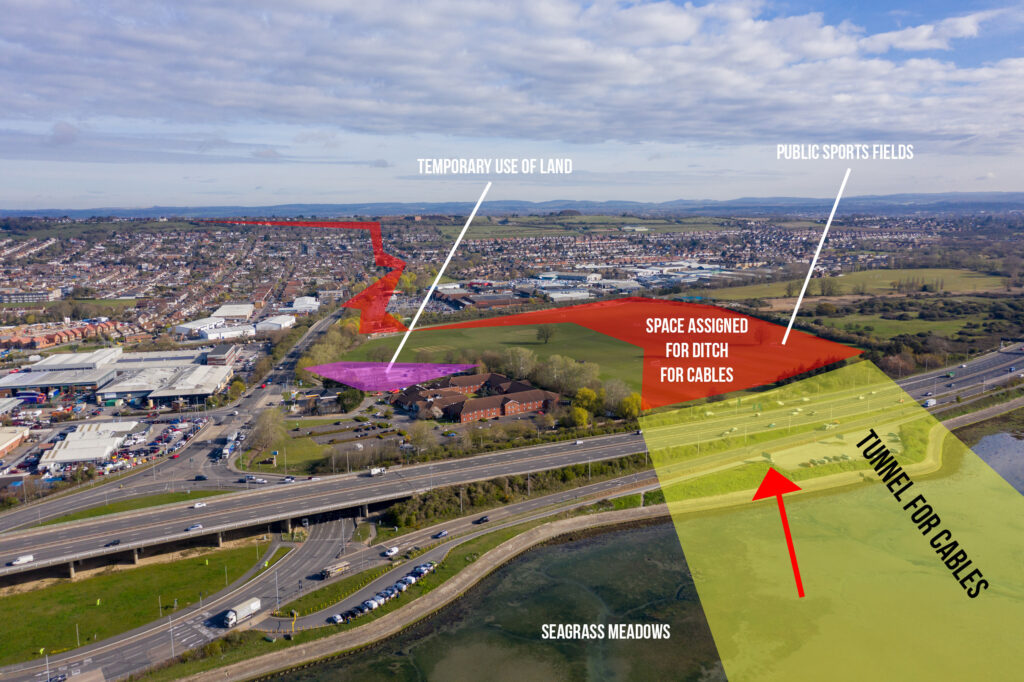
The cables will tunnel under the busy motorway before a huge proportion of the Farlington playing fields is taken over for ditches. These fields are used all year round for sports by the local community. The carpark for the playing fields will also be taken over temporarily. The cables then head north through Sainsbury’s supermarket carpark before cutting up the dual carriageway.
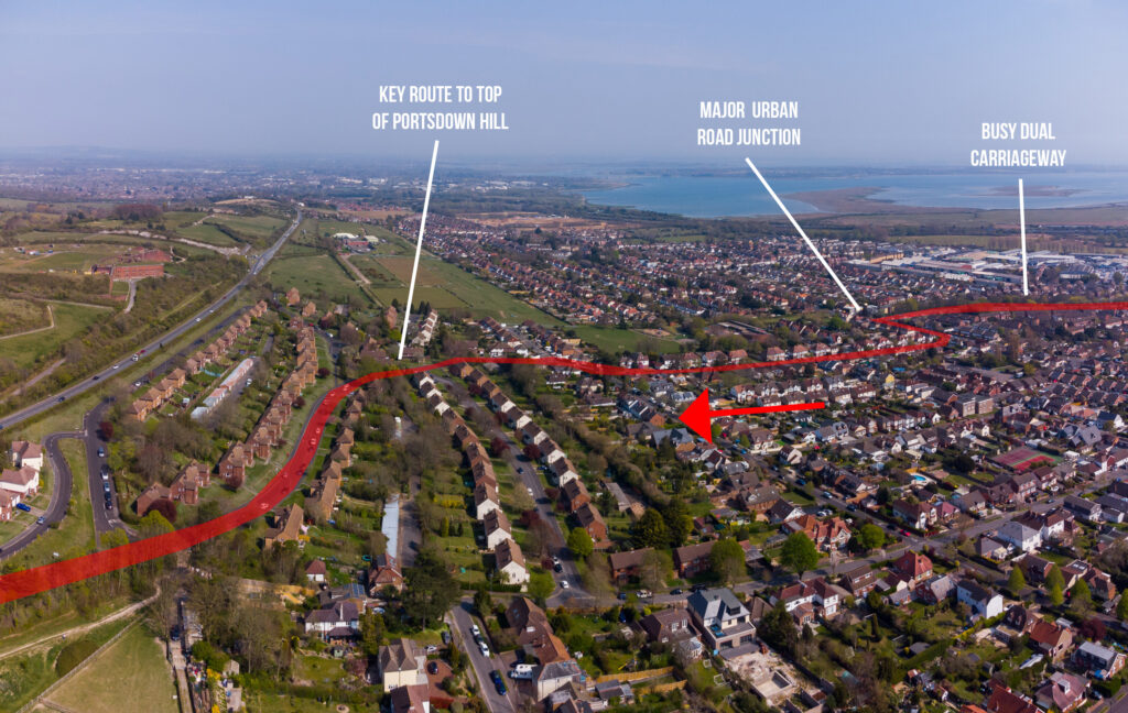
From here the cables trenches will run up the main route to the top of Portsdown Hill past houses and by a school.
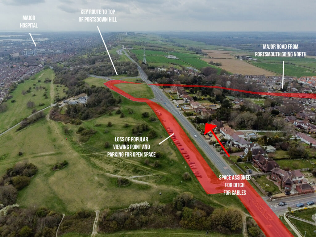
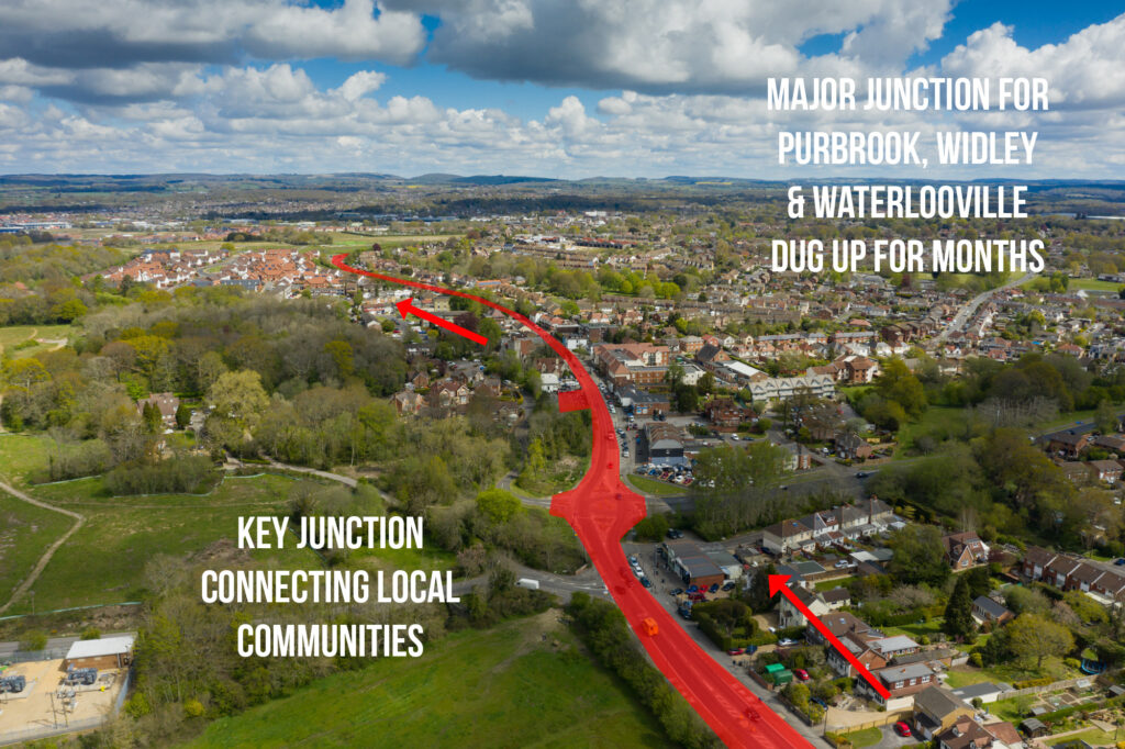
The deep trenches go west along the top of Portsdown Hill, including through a popular viewing spot carpark which also is used for people to access the green spaces here. The trenches then cut into the main road (which provides direct access south to QA Hospital) before running north into Purbrook and leaving Portsmouth.
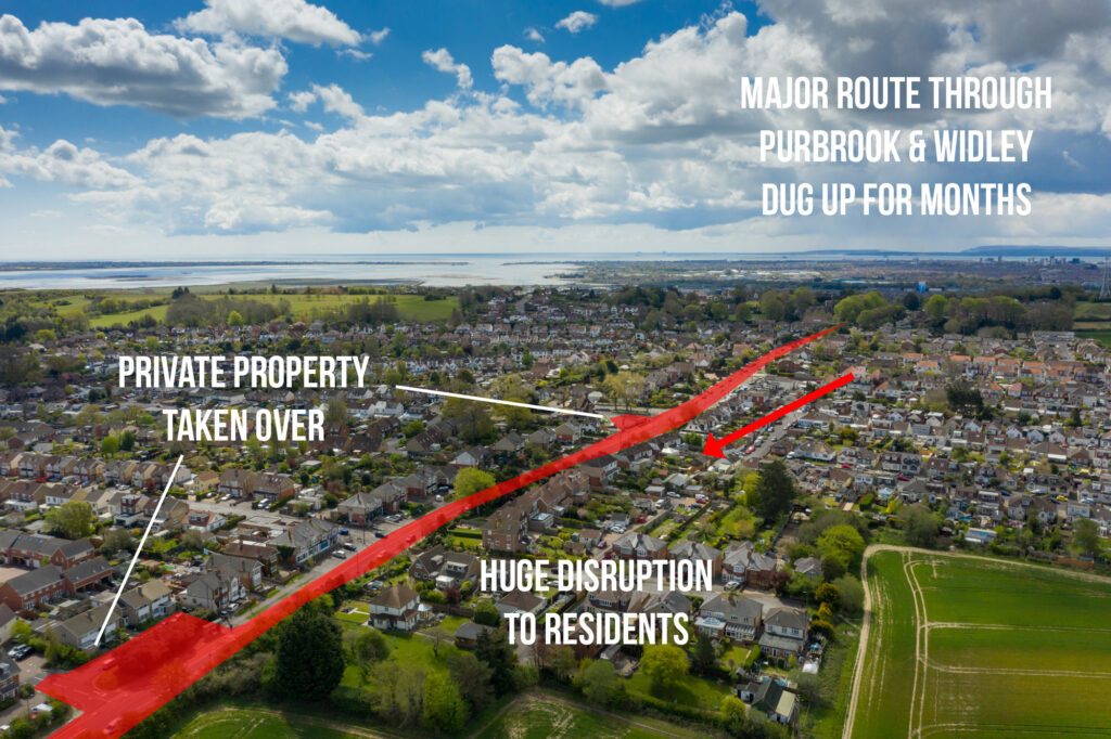
This major north/south road runs from the top of Portsdown Hill, through Purbrook and Widley, and down towards Waterlooville. The area is residential, a major public transport route, and a key route to the hospital, and there will be major disruption with the road dug up for months at a time. Some privately owned areas will be taken over during the construction.
At the bottom of the hill from Purbrook running north to Waterlooville the major roundabout connects many different communities and provides a link to the college and shopping/retail.
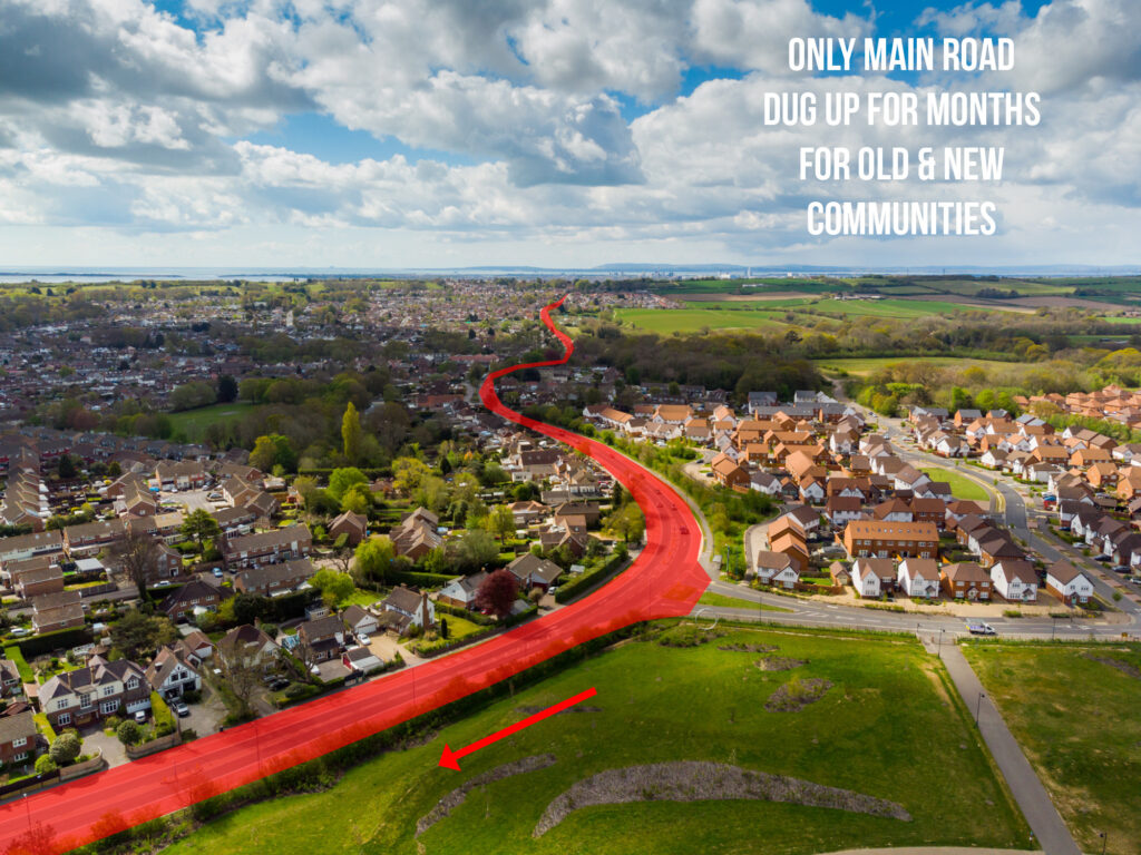
This major road continues north and is a vital link for people both in long-standing and new communities, disruption will impact thousands of families for many, many months, or even years.
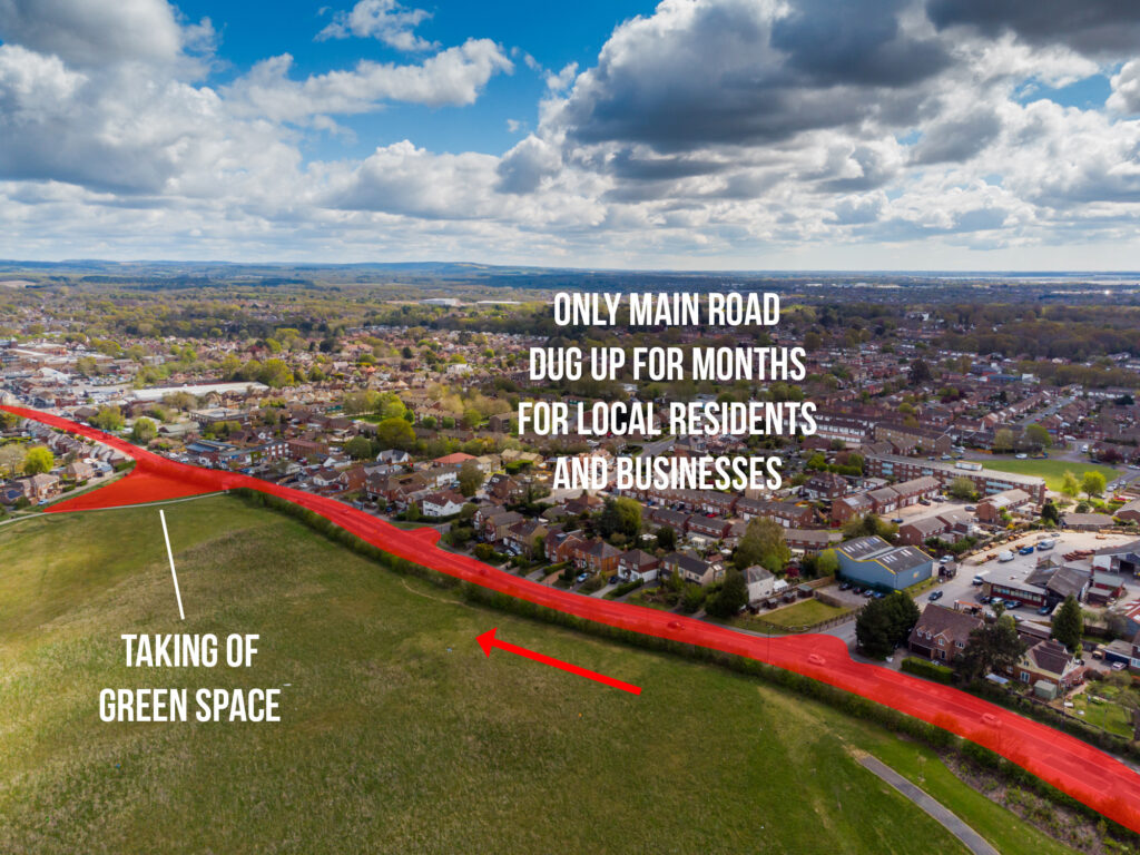
Not only is the main road dug up to lay the cables but areas of public green space will be taken over during the planned construction work. At this point in Waterlooville and north through to Denmead there are many, many businesses that depend on this vital road link.
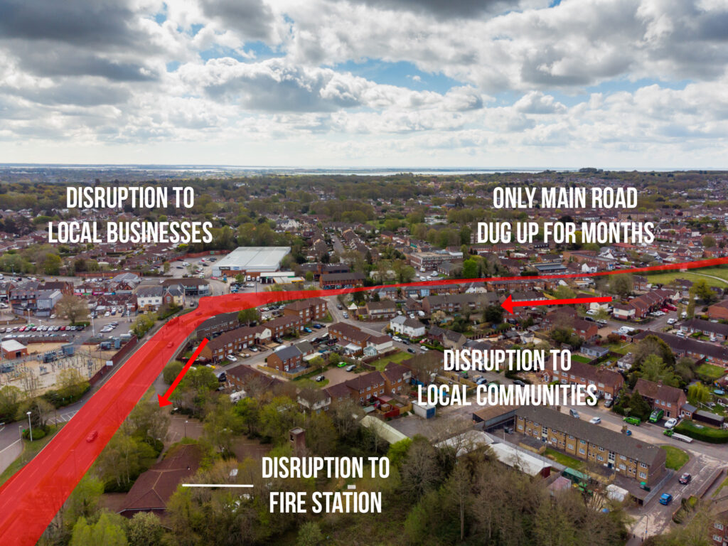
The Aquind Interconnector proposed route follows the main road into the centre of Waterlooville, impacting local businesses, retails and also the main fire station, which is on this main road.
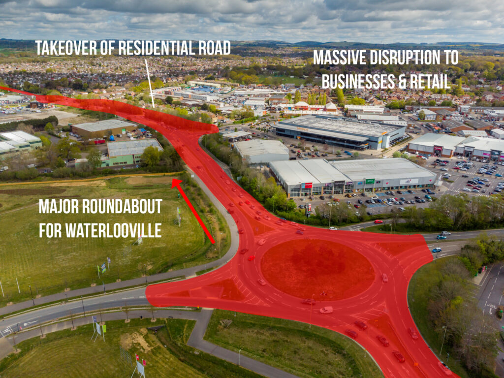
This very busy roundabout connects two main routes through Waterlooville and also access to a major retail park as well as a large business park, the high street parking and a major new residential development. the disruption at this point will have far-reaching implications for local families, businesses both small and large and visitors to the area.
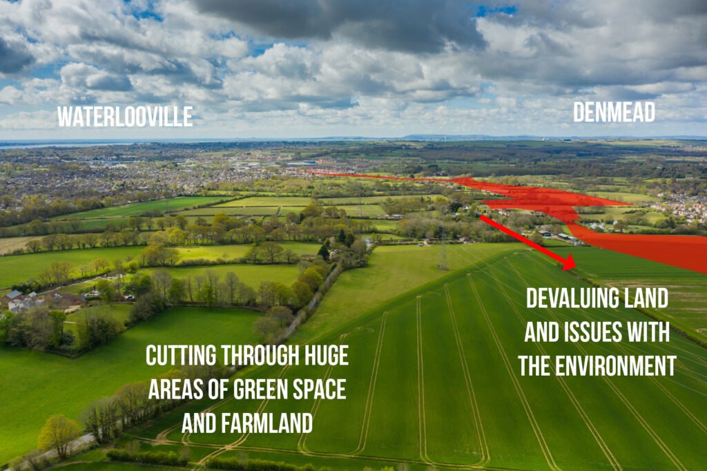
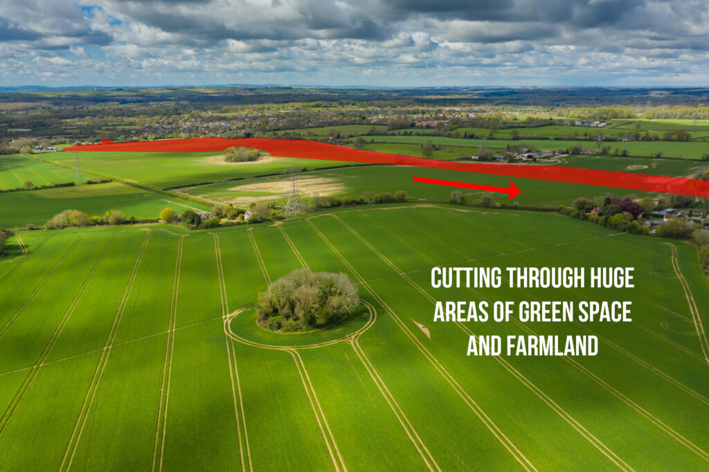
Moving through Waterlooville and out towards Denmead and Lovedean the route now cuts deeply into the countryside of the South Downs, through green spaces and then farmland. This will impact both crops and harvests, the value of land and also be detrimental to the local environment and wildlife.
The route moves north towards the Lovedean Sub Station, with huge swathes of farmland taken over. Local people will have this development both on their land and right by their homes, with access routes also takeover to the development.
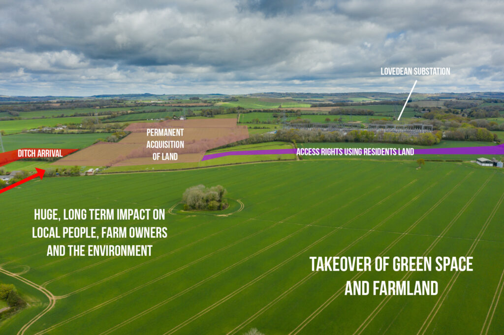
The route will finally end with a very large area of land by the Lovedean Sub Station, purchased against the wishes of local people. Building a large building and the general construction will both change the landscape, impact local people and wildlife but will also require disruptive access routes cutting through people’s land/gardens and via public paths and roads. This area will never be the same again.